🖍️Shop USA Map Coloring Books –>
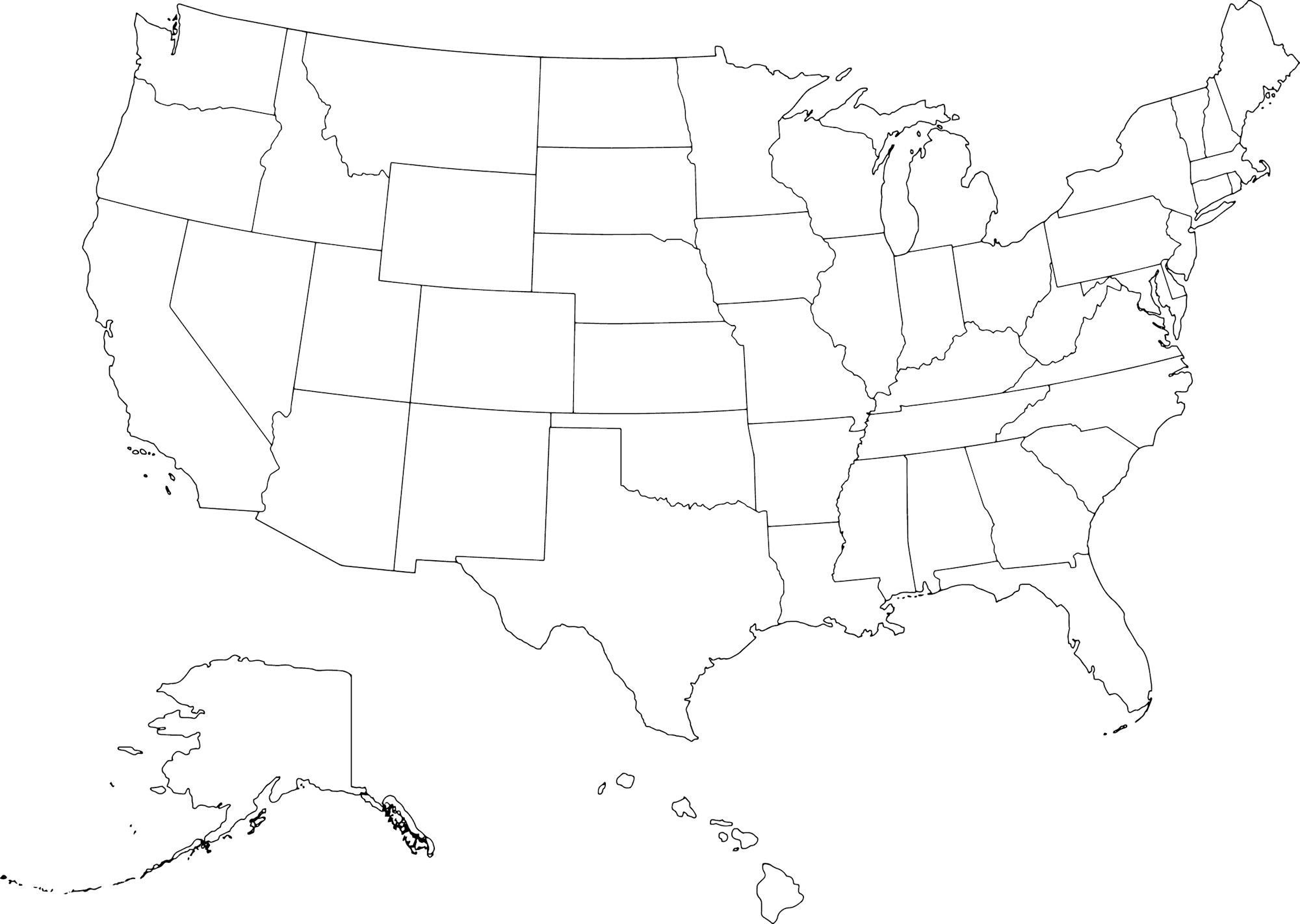
Maps are a wonderful way to help children see how individual places fit together. With a few crayons or colored pencils, the outline of the United States can become a geography activity, a travel map, a patriotic art project, or simply a colorful way to become more familiar with the shapes of the states.
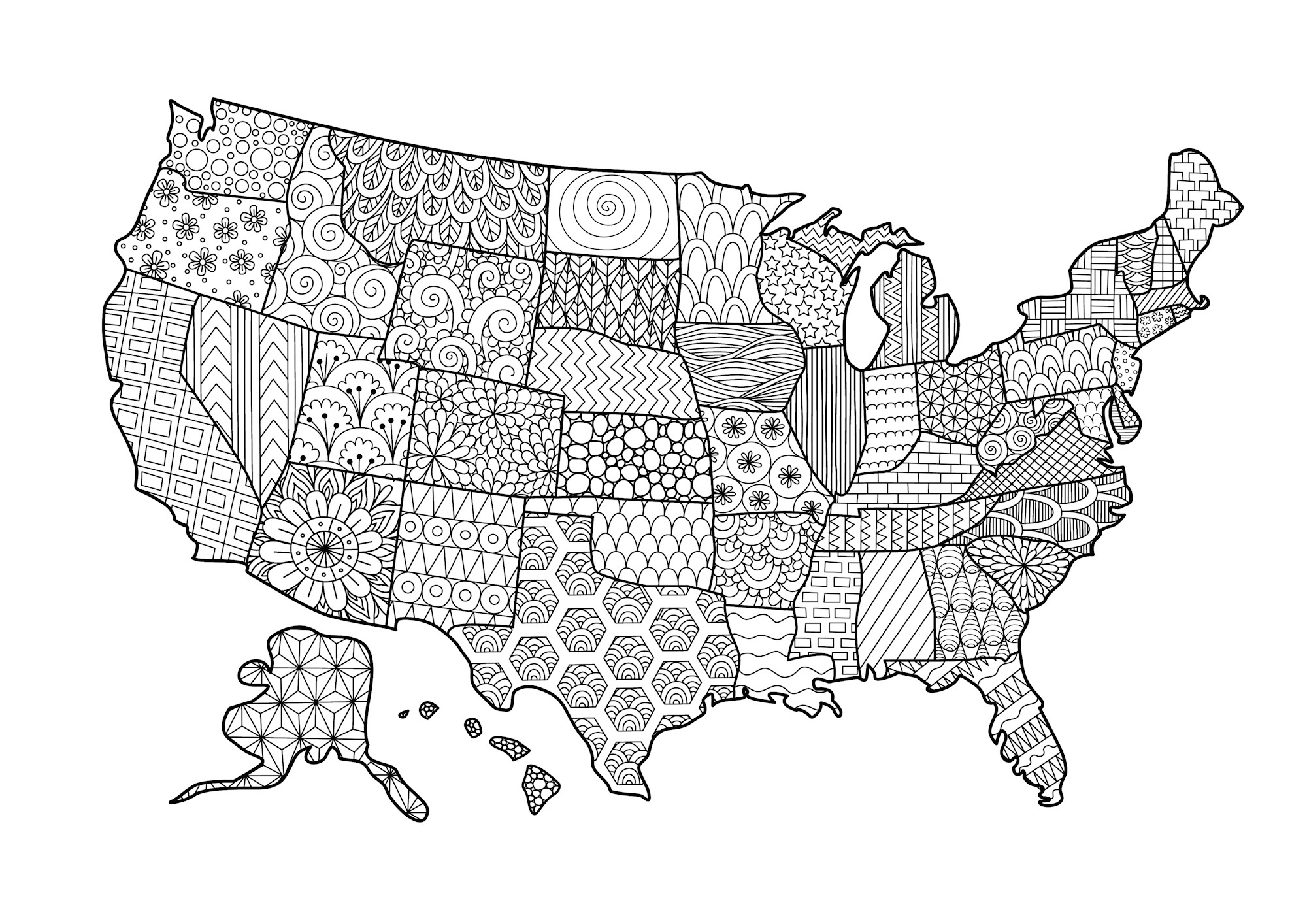
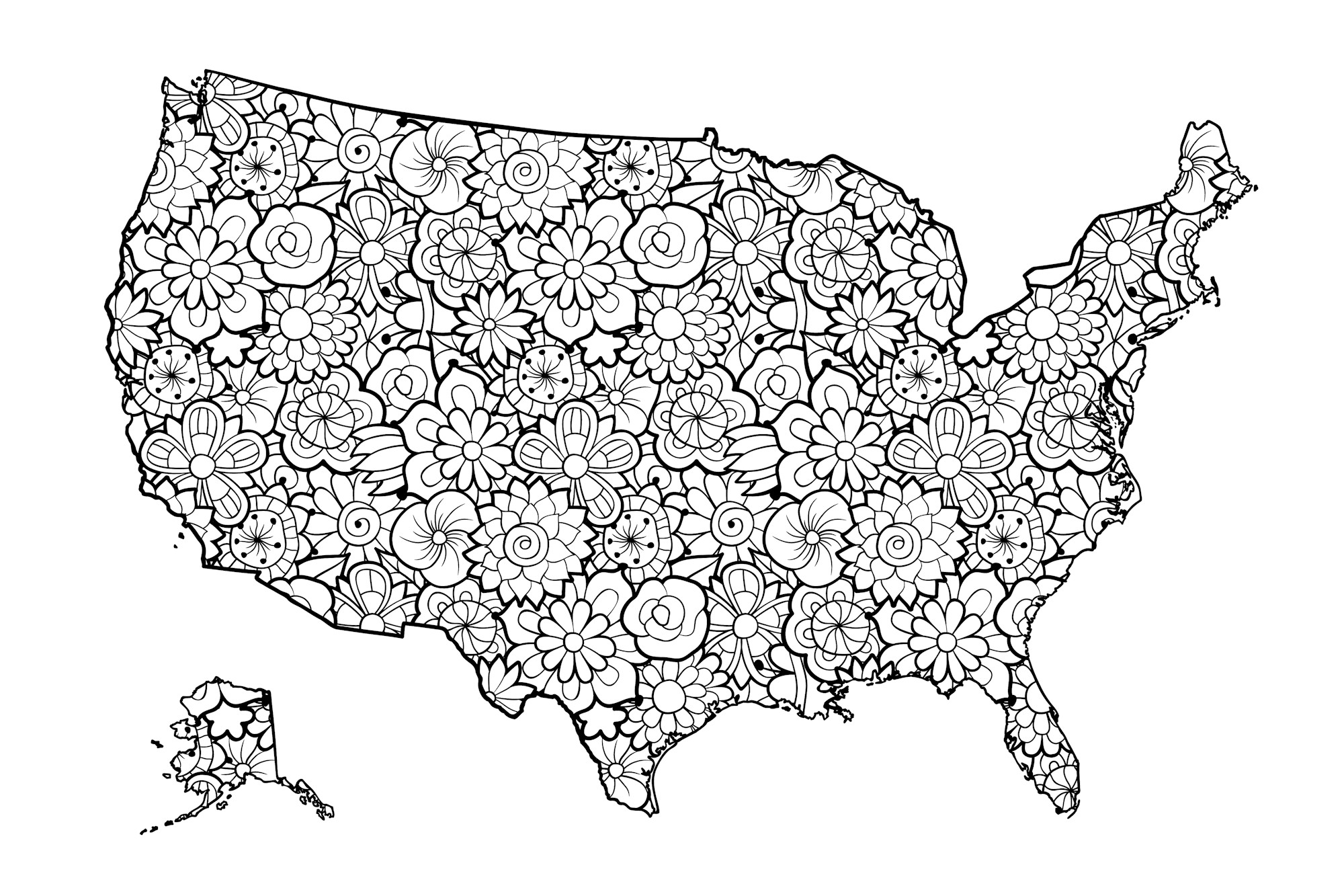
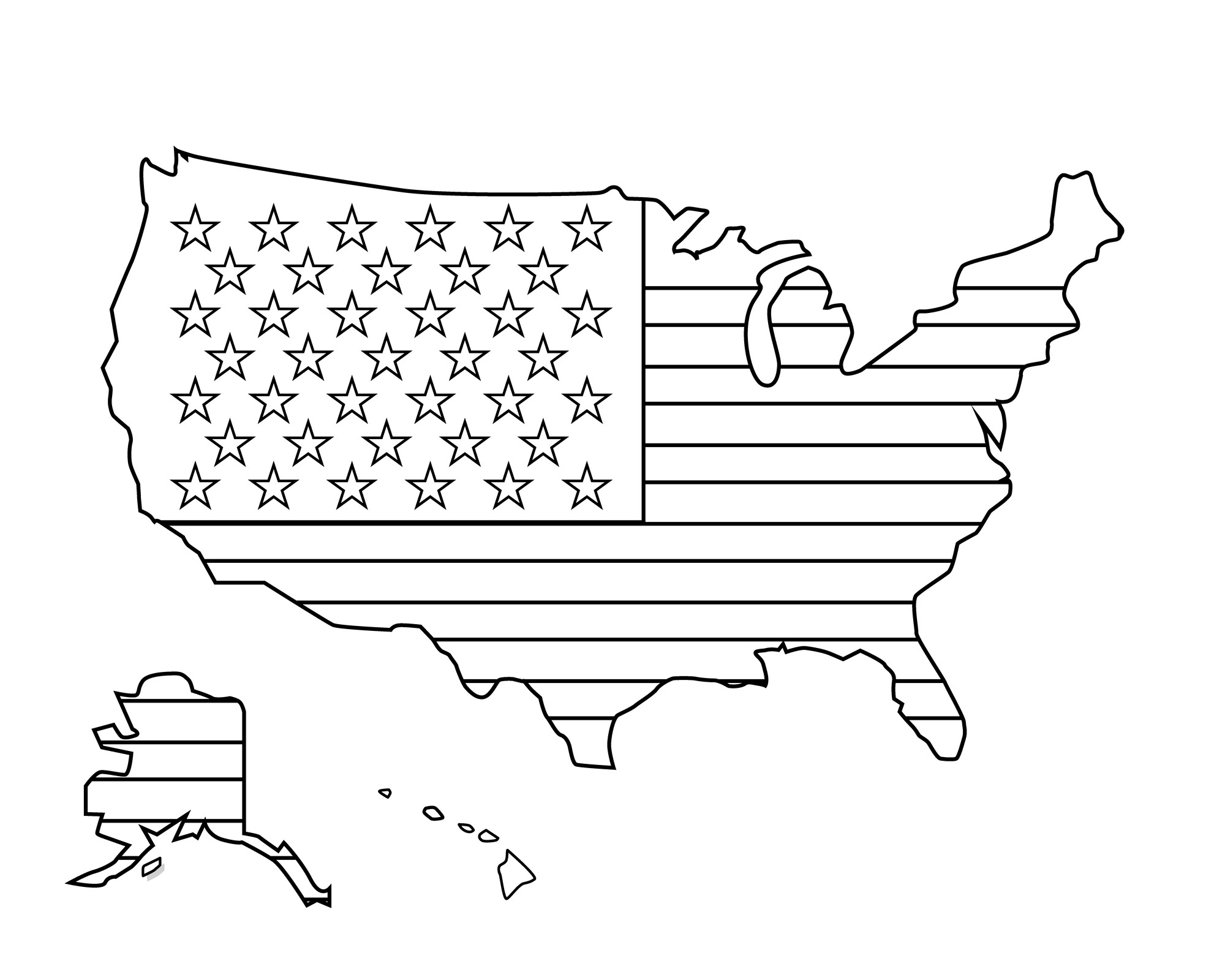
Our Coloring Pages of the USA Map collection includes several different ways to explore the country through art. You’ll find a classic map of the United States, decorative floral USA maps filled with flowers, and an American flag design shaped like the country. Some pages are ideal for practicing geography, while others are detailed enough to enjoy simply as creative coloring projects.
Children can color every state differently, label places they recognize, mark states they’ve visited, or create a map showing where family members live. Older kids can add capitals, regions, mountain ranges, rivers, and other geographic features. The floral and flag designs can also be colored purely for fun, making this collection useful for classrooms, homeschool lessons, road trips, U.S. history activities, and quiet creative time at home.
Grab your crayons, markers, or colored pencils and start exploring the United States one state at a time.
🗺️ Start With a Classic USA Map
The simple USA map is one of the most flexible pages in the collection because it can grow with the child using it. Younger children might simply enjoy filling the country with their favorite colors, while older kids can use the same map to practice identifying states, regions, coastlines, neighboring countries, and important geographic features.
One easy approach is to give neighboring states different colors so their boundaries stand out. You don’t need 50 different crayons. A small group of red, orange, yellow, green, blue, purple, and pink can be repeated across the country. The finished map will have a colorful patchwork effect while still making individual state shapes easier to notice.
As children work, encourage them to look closely at those shapes. Florida’s long peninsula, Texas’s distinctive outline, California’s Pacific coastline, and Michigan’s two peninsulas are often easier to recognize first. Smaller states in the Northeast may take more practice, and that’s perfectly fine. A map becomes familiar gradually.
🇺🇸 Learn the 50 States Through Coloring
The United States has 50 states, and learning all of their names and locations can feel like a huge task when a child first looks at a blank map. Coloring allows that process to be broken into smaller, more manageable pieces.
Rather than trying to memorize everything at once, choose a few states at a time. Color them, say their names aloud, and find them again later. A child might begin with California, Texas, Florida, Alaska, Hawaiʻi, and their own home state before gradually expanding to neighboring states and larger regions.
Older children can write state names directly onto the map. State postal abbreviations are useful when there isn’t enough space for a complete name, particularly in the Northeast. The map can then be printed again later to create a blank-map challenge. See how many states can be identified without looking at the completed version, then use the first map to check the answers.
The goal doesn’t need to be instant memorization. Repeatedly seeing, coloring, naming, and locating states builds familiarity over time.
🎨 Color the United States by Region
Another way to make a 50-state map easier to understand is to group states into regions. The U.S. Census Bureau uses four major census regions: Northeast, Midwest, South, and West. These are useful for statistical purposes, although you’ll encounter other regional groupings in books, schools, travel guides, and everyday conversation.
Try choosing one color for each Census region. The Northeast might be purple, the Midwest green, the South orange, and the West blue. Once the map is complete, the broad geographic pattern becomes much easier to see.
Regional coloring can also lead naturally to discussions about landscapes and climate. The western United States includes deserts, mountains, forests, and Pacific coastlines. The Midwest contains large agricultural areas and the Great Lakes. The South includes Atlantic and Gulf Coast states along with inland landscapes, while the Northeast includes New England and the Middle Atlantic states.
Those descriptions are necessarily broad—every region contains tremendous variety—but they provide an approachable starting point for exploring the country.
🧭 Add Directions, Oceans, and Neighboring Countries
A USA coloring page can also become a simple map-reading lesson. Add a compass rose somewhere around the edge and label north, south, east, and west. Children can then use those directions to describe where states and other places are located.
Ask questions such as, “Is California on the eastern or western side of the country?” or “Which direction would you travel from Texas to Colorado?” A child doesn’t need to know every state to begin understanding how direction works.
The map also makes it easy to introduce the Atlantic Ocean along the East Coast and the Pacific Ocean along the West Coast. Alaska borders both the Pacific and Arctic Oceans, while Hawaiʻi is surrounded by the Pacific. Add ocean labels and use several blues or turquoise shades around the coastlines if the design leaves enough room.
Children can also label Canada to the north and Mexico south of the southwestern United States. That provides an important reminder that the United States is part of the larger continent of North America rather than an isolated shape on a worksheet.
For a broader geography activity, place the finished USA page beside our World Map Coloring Pages and find North America on the globe.
⭐ Understanding Alaska and Hawaiʻi on USA Maps
Alaska and Hawaiʻi deserve a little extra attention because many printable maps show them in boxes below or beside the 48 connected states. Those inset boxes make the whole country easier to fit onto one page, but they can also give children an inaccurate impression of where the two states are actually located.
Alaska lies far northwest of the other states and is separated from them by Canada. Hawaiʻi is an island chain in the central Pacific Ocean. Neither state is actually located in the little space where a classroom map may place its inset.
The size of Alaska may also be changed significantly in an inset, so a simple coloring map shouldn’t be treated as a scale model. Comparing the page with a globe or a correctly scaled reference map can help children understand the difference.
Official geographic terminology can be confusing too. The conterminous United States consists of the 48 adjoining states and the District of Columbia, excluding Alaska and Hawaiʻi. The official definition of the continental United States includes Alaska because it is on the North American continent, but excludes Hawaiʻi.
For younger children, saying “the 48 connected states” is usually much easier.
If Hawaiʻi becomes a favorite part of the map, continue exploring with our Coloring Pages of Hawaii.
🌺 Color the Floral USA Maps
Not every map activity needs to focus on memorizing states. The floral USA designs in this collection offer a more decorative approach, filling or surrounding the familiar country shape with flowers and botanical details.
These pages are especially nice for experimenting with coordinated palettes. A spring-inspired map could use dusty pink, lavender, pale yellow, sky blue, and fresh green. A brighter wildflower version might combine purple, orange, red, yellow, blue, and several shades of green. For something softer, try peach, mint, pale pink, lavender, and baby blue.
Older colorists might prefer a vintage palette of burgundy, dusty rose, olive, cream, and muted gold. Because the flowers repeat throughout the design, using the same handful of shades in different combinations helps the entire map feel connected.
The floral pages can also become wall art once completed. Color two versions differently and display them side by side, or use school colors, favorite colors, or shades associated with a particular season.
For more botanical coloring, pair these maps with our Coloring Pages of Flowers.
🇺🇸 Color the American Flag USA Map
Another design combines the shape of the United States with the familiar pattern of the American flag. A traditional version calls for red, white, and blue, making this page useful for patriotic holidays, U.S. history lessons, or discussions about national symbols.
The current United States flag contains 50 white stars, representing the 50 states, and 13 horizontal stripes, representing the original 13 colonies that became the first states. Seven stripes are red and six are white. The flag has changed several times throughout U.S. history as additional states joined the Union, while the 13-stripe pattern has been retained since the early 19th century.
Children don’t need to reproduce every tiny star perfectly on a detailed coloring sheet. A blue star field and alternating red-and-white stripes will create the recognizable design.
Of course, coloring pages are also creative spaces. A second copy could become a rainbow flag map, a floral flag, or a completely imaginative red-purple-turquoise version. Comparing the traditional and artistic versions can be a fun way to distinguish between learning what a real symbol looks like and creating personal artwork inspired by it.
🏙️ Add State Capitals and Other Geography Details
Once children become comfortable identifying the states, the same basic USA map can support more advanced geography activities. Instead of coloring only state boundaries, add state capitals using small dots or stars.
Begin with a manageable number. A child might add Sacramento for California, Austin for Texas, Tallahassee for Florida, Denver for Colorado, and Honolulu for Hawaiʻi before gradually expanding to other states.
Washington, D.C. can be marked separately. It is the capital of the United States but is not one of the 50 states.
Older students can create a small map key so symbols are easy to interpret. For example, a star might represent a capital, triangles can represent mountains, a blue line can represent a river, and a heart might show a place the family has visited.
Once children understand what a legend or key does, they can invent symbols that match whatever information they’re mapping.
🏔️ Add Mountains, Rivers, and the Great Lakes
Political boundaries are only one way of looking at the country. A USA outline can also become a physical-geography project.
Older children can mark broad locations of important mountain systems such as the Rocky Mountains, Appalachian Mountains, Sierra Nevada, and Cascade Range. Simple triangular mountain symbols are enough; there is no need to reproduce every ridge precisely.
Major rivers can be added in blue. The Mississippi, Missouri, Colorado, Rio Grande, and Columbia are good examples for a first physical-geography map. Trying to include every major river would quickly become too crowded, so choosing a handful usually works better.
The Great Lakes—Superior, Michigan, Huron, Erie, and Ontario— provide another recognizable feature along the northern United States. Lake Michigan is entirely within the United States, while the other four form part of the international boundary with Canada.
Kids who enjoy adding mountains, water, and other scenery may also like our Coloring Pages of Landscapes.
✈️ Create a States-I’ve-Visited Map
A USA coloring page doesn’t have to be a school assignment. It can become a personal travel map too.
Choose one color for states you’ve visited and another for places you’d like to see someday. For example, visited states might be green, wish-list states yellow, and places not yet explored can remain white.
Family members can make their own copies and compare them. Perhaps everyone has been to Florida, but only one person has visited Montana. Maybe Hawaiʻi, Alaska, California, or Maine appears on everyone’s travel wish list.
The completed map can be placed inside a family scrapbook or travel journal. Add dates, tiny stars, notes, or drawings to remember special trips. Children might draw a beach beside a coastal vacation, mountains near a hiking destination, or a little car along the route of a memorable road trip.
🚗 Plan an Imaginary Road Trip Across the USA
Maps are also great tools for imaginary travel. Choose a starting point and destination, then draw a dotted route between them.
Maybe the trip goes from Florida to Maine, California to New York, Illinois to Arizona, or Texas to Colorado. Ask which states might be crossed along the way, and check a road map or digital map afterward to see how close the imagined route was.
Children can add small illustrations representing things they’d like to see. Mountains, beaches, forests, national parks, cities, animals, or foods can all become little symbols along the route.
A road-trip coloring activity helps children see states as connected places rather than isolated shapes. It also introduces the idea that distance and direction matter when traveling across such a large country.
❤️ Turn the USA Map Into a Family Map
Another simple project is to use the country map to show family connections. Mark home with a large star, then add hearts in states where grandparents, cousins, friends, or other relatives live.
Children can begin to see whether loved ones live nearby or on the opposite side of the country. Older kids can estimate direction and distance or trace possible travel routes between locations.
The same idea works for places where family members were born, former hometowns, favorite vacation destinations, or states associated with meaningful memories.
Instead of becoming a generic classroom map, the finished page becomes a visual picture of a family’s own connections across the country.
🌲 Create a National Parks and Nature Map
Nature lovers can use the blank outline to explore national parks and landscapes. Choose a few well-known parks and mark their approximate locations with green stars. Yellowstone, Yosemite, Grand Canyon, Great Smoky Mountains, Everglades, Acadia, Denali, and Hawaiʻi Volcanoes are only a few possibilities.
There is no need to fit every park on one page. Select several that connect with places being studied or destinations a child would like to visit.
Another option is to color broad parts of the map according to imagined landscapes rather than state lines. Use greens for forests, tan for deserts, gold for grasslands, brown and gray for major mountain areas, and blue for lakes and rivers. This won’t create a precise scientific land-cover map, but it can introduce the idea that the United States contains an enormous variety of environments.
From Alaska’s Arctic landscapes to Hawaiian volcanoes, southwestern deserts, Appalachian forests, Great Plains grasslands, wetlands, mountains, and thousands of miles of coastline, there is far more geographic variety than a simple outline initially reveals.
📜 Use Maps to Explore U.S. History
A modern map can also lead to an important history lesson: the boundaries of the United States have not always looked the way they do today.
Historical maps preserved by institutions such as the Library of Congress show changing colonies, territories, states, transportation routes, settlements, and borders. The country’s expansion from the original states along the Atlantic coast to its present boundaries involved a complicated history of colonization, treaties, purchases, wars, annexations, settlement, migration, federal policies, and profound consequences for Indigenous peoples and other communities already living on the land.
For older students, comparing a modern coloring map with one or two historical maps can be far more illuminating than presenting U.S. expansion as a simple sequence of states being added.
It is also worth remembering that today’s state boundaries are only one way of mapping the land. Native nations lived throughout North America long before modern state lines existed, and Tribal Nations continue to have their own governments, histories, cultures, and relationships with land today.
A coloring map can introduce modern political geography while leaving room to explore the much larger history behind those boundaries.
🔎 Turn the USA Map Into a Game
Once the map has been colored a few times, use it for simple geography games. Ask children to find a state on the Pacific Coast, locate one that borders Canada, point to a state touching Mexico, or identify a state near one of the Great Lakes.
Another game is to choose a letter and find states beginning with it. The letter A, for example, gives you Alabama, Alaska, Arizona, and Arkansas. The letter M produces an even longer group.
You can also mix geography with counting. How many states have been visited? How many are on the wish list? How many states are in a particular Census region? How many begin with the same letter?
For more number activities, our Coloring Pages with Numbers provide an easy companion activity.
Our Coloring Pages of Games can also add mazes, I Spy games, dot-to-dot activities, and other printable challenges to a geography-themed activity folder.
🏫 USA Map Activities for Classrooms and Homeschool
Because one map can be reused in so many ways, USA coloring pages work particularly well for classrooms and homeschool geography. Instead of trying to fit every concept onto one overloaded map, print several copies and give each one a clear purpose.
One page might show the 50 states, while another focuses on the four Census regions. A third could mark capitals, a fourth might show mountains and rivers, and another can become a personal travel map. Comparing those finished pages helps children understand that maps can display different types of information about the same place.
The floral and flag maps offer creative breaks between more geography-focused activities. They can also be used for classroom displays, patriotic projects, art centers, early-finisher activities, and collaborative coloring.
For an especially useful long-term project, place a USA map at the beginning of a 50 States notebook. Each time a state is studied, add a page with its name, capital, abbreviation, region, landscapes, and a few things the child would like to remember. The map then becomes the visual anchor for the whole project.
🖍️ Choosing Colors and Coloring Supplies
Crayons are usually easiest for younger children because many western and central states contain fairly large spaces. Markers produce bold boundaries and can work especially well on the American flag design, although they may be harder to control around small northeastern states.
Colored pencils offer the most precision for detailed floral maps and smaller geographic areas. Keeping a pencil sharp can help around places such as Rhode Island, Delaware, Connecticut, and New Jersey.
There is no requirement to color every inch of a geography map. Children might outline each state and leave the centers mostly white, color only the regions they’re studying, or add patterns instead of solid colors.
For a more decorative version, try a coordinated palette such as red, white, and blue; pastel pink, mint, lavender, and yellow; earthy olive, rust, brown, and cream; or a complete rainbow. A map can be geographically useful and still look beautiful.
🌎 Explore Beyond the United States
Once the shape of the United States feels familiar, zoom out.
Our World Map Coloring Pages allow children to locate North America and see how the United States fits into the much larger world. They can find Canada and Mexico again, identify the Atlantic and Pacific Oceans, and begin exploring the other continents.
The two map collections work especially well together. The world map answers “Where is the United States?”, while the USA map answers “What’s inside it?”
That shift in scale is an important part of learning geography. A child gradually moves from understanding home and neighborhood to city, state, country, continent, and world.
Coloring provides a simple visual way to make those relationships easier to see.
🇺🇸 Explore the United States One State at a Time
These Coloring Pages of the USA Map can be as simple or as educational as you want them to be. Younger children can fill the country with rainbow colors and begin recognizing a few memorable state shapes. Older kids can label all 50 states, learn capitals, color regions, add mountain ranges and rivers, or compare the modern United States with historical maps.
The decorative designs offer something different. Fill the floral maps with botanical color, create a traditional red-white-and-blue flag map, or transform either one into a completely original piece of art.
Maps can also become personal. Mark where you live, where relatives are, states you’ve visited, and places you’d like to explore. Plan a road trip, build a national-parks map, or create a 50 States notebook that grows throughout the school year.
There is no need to learn the entire country at once. Begin with your own state, find a neighboring state, and keep exploring from there.
One state eventually becomes five. Five become a region. Before long, that complicated collection of shapes begins to look familiar.
All it takes to start is a map—and a little color.
Happy coloring and happy exploring!
🔗 Related Coloring Pages & Activities
- World Map Coloring Pages
- Coloring Pages of Hawaii
- Coloring Pages with Numbers
- Coloring Pages of Games
- Coloring Pages of Landscapes
- Coloring Pages of Flowers
- Educational Coloring Pages & Activities
- Map Coloring Pages
📚 Sources
- U.S. Geological Survey — What Constitutes the United States? Official Definitions
- U.S. Census Bureau — Census Regions and Divisions
- Smithsonian National Postal Museum — The First Flag Act and the Stars and Stripes
- Smithsonian Institution — Facts About the Star-Spangled Banner
- Library of Congress — Boundaries of the United States and the Several States and Territories
🖍️Shop USA Map Coloring Books –>